Intro
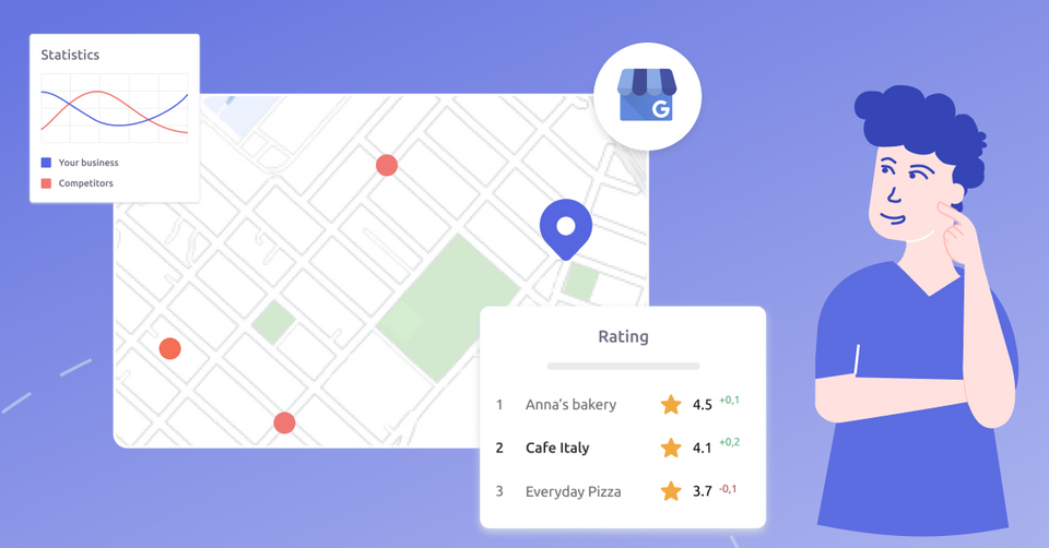
We need online maps to get to the location when we’re looking for something. It could be a local store, restaurant, or barbershop. We would start looking for it in a search engine, which will show us location-based results. We need to find the right address and a direction on how to get there. That also shows how our journey is being transferred from a search engine bar to online maps and review services (as we might not only look for a direction but also check reliability of business, especially if this business is new to us). In addition to that, more and more people start using the search options directly in online maps to check what’s available near them. However, not only we, as customers need that.
Companies need that as well to guide us to their outlets. Google first comes to mind, and it’s not a big surprise, as Google dominates the search engine market with a stunning 92,74%. Thus, Google Maps and Local Search should be of primary importance in the current market realities. However, one shouldn’t forget about some alternatives, that despite not being that dominant, still exist, and that could be especially interesting for people who don’t like being stuck with only one option. There’s Bing Maps from Microsoft.
Evolution of Bing Maps
The mapping service from Microsoft has also undergone some serious changes over time. We’ve already covered a historical transformation of Google Business Profile in our GMB to GBP: Evolution of Google Business Profile and it would be interesting to compare different stages of Bing Maps as well.
Bing Maps was originally launched as MSN Virtual Earth for beta testing on July 25, 2005. It was a continuation of such previous Microsoft technologies as MapPoint and TerraServer. Among the first feature set one of the most interesting was the aerial imagery, however such typical features for online maps as birds’ eye view and 3D maps were missing.
In December 2005, Virtual Earth was replaced by Windows Live Local. A couple of new features have been added there, such as a 45-degree bird’s-eye that had been applied to the major US cities such as New York, Los Angeles, San Francisco, Boston, Seattle, and Las Vegas, integration with road and satellite maps to simulate 360-degree panoramas that can be viewed from four compass directions and on-screen navigational tools with the ability to zoom in.
Later to that in November 2006 Microsoft added the ability to view Maps in 3D and subsequently began referring to this product as “Live Search Maps” while integrating it as a part of its Live Search Services. Thus, Microsoft seriously entered the “online maps game”.
From the branding perspective, Microsoft officially rebranded Live Search Maps as Bing Maps on June 3, 2009 and the Virtual Earth Platform as Bing Maps for Enterprise and it was intact with the company’s new search engine that was about to be released. Interesting, how the company itself differentiated these services back then: “Live Search Maps was our consumer maps offering. This is the website you go to for maps, aerial photos, directions, searching for points of interest, and creating collections of your own personal data to store in the cloud” and “Microsoft Virtual Earth was our enterprise mapping platform. This was the set of APIs you would leverage to embed maps into your website along with overlay data in the form of pushpins, polygons, polylines, raster overlays, etc., etc. Microsoft Virtual Earth is now called "Bing Maps for Enterprise.” Thus this transformation continued with the further Microsoft’s transformation of its search engine and mapping tools.
Further updates followed the suite. In 2010 an OpenStreetMap layer was added to Bing Maps and in 2012 Nokia started powering lots of features of Bing Maps (as an extension of the partnership around Windows Phone 7), especially as: mapping data, geocoding, traffic data, and navigation. This partnership actually started in 2009 and later only extended.
That’s how Microsoft explained it’s partnership in their official blog: “You see, while Navteq is out there collecting the best of breed road information inclusive of speed limits, bridge heights, turn restrictions, one-way streets (you know, important information so you don’t get killed navigating with their data) we figured it prudent to strap a few cameras on their vehicles to record some photos. How’s that for scaling out?” Not a bad explanation.
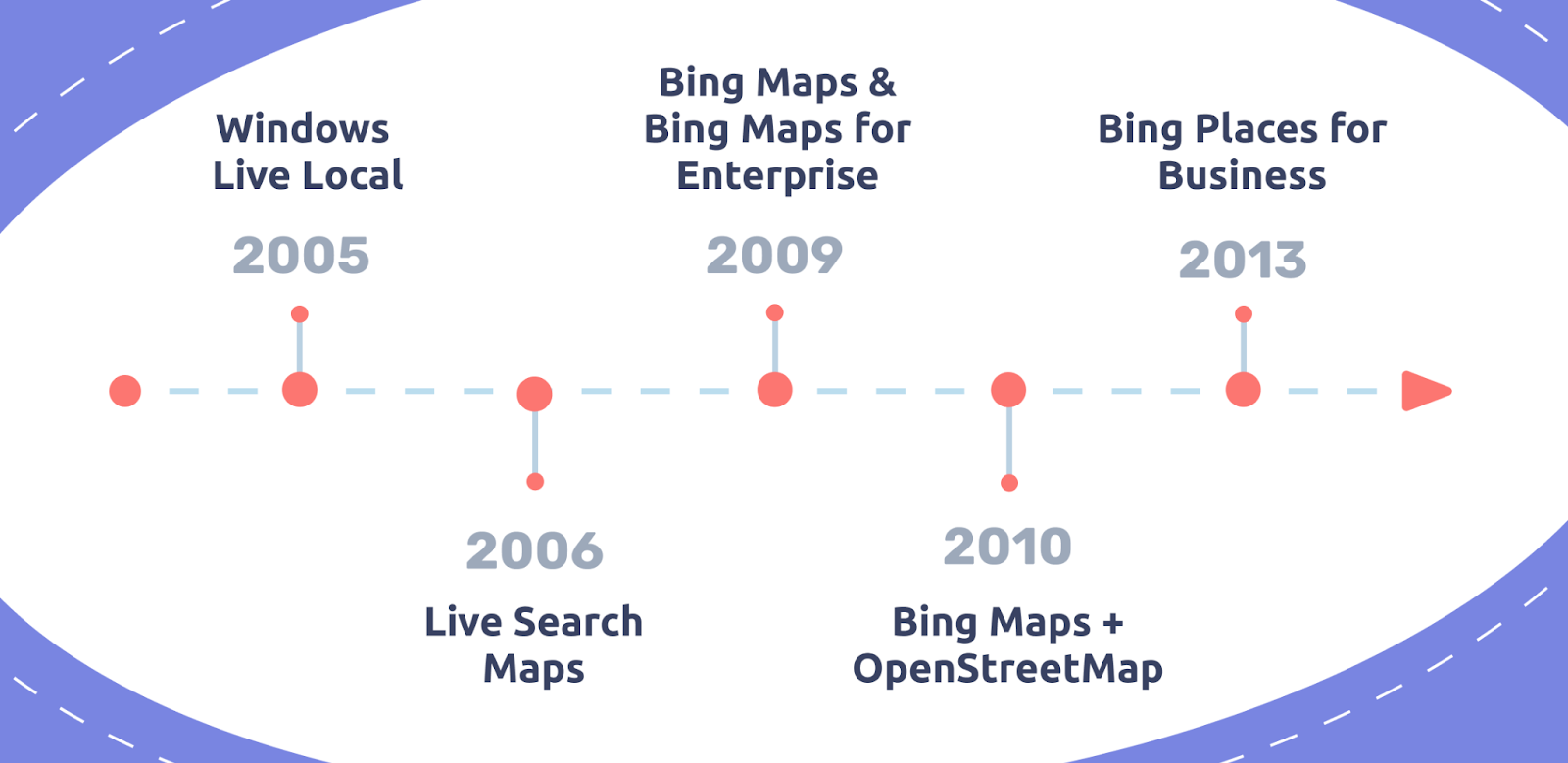
In April 2013 Bing renamed its local listing product from Bing Business Portal to Bing Places for Business (does it already remind you of something?) and allowed business owners to claim and verify their online listing. That should help businesses to simplify management of online reputation. As has been stated by Ginny Sandhu (then Senior Product Manager of Bing): “Our goal is to make it easier to claim, enhance and promote businesses on Bing”. Moreover, Bing also seriously enhanced their international presence.
Since then there was a couple of updates, but Bing's focus and philosophy largely remained the same and it maintained a connection with HERE on various topics (street data, pulling postal imaging, and other data from a variety of third-party and proprietary sources) even despite the fact that HERE, which used to be called Navteq and belonged to Nokia, was sold to a few German car companies in 2015. That’s enough for history of Bing Maps and let’s dig into some features of it.
Curious to know about pros and cons of using Bing Maps? Wait for our next article :)